
The Complete Guide to ENC Charts, Files and Updates
What an official ENC is, what is inside the files that update it every week, how cells are named, protected and checked, what SOLAS asks of a ship — and what S-100 will change.
ENC charts are the official vector charts an ECDIS navigates by, and every week a new batch of files arrives to keep them current. This guide explains what those files are and how often they must be applied, how ENC cells are named, protected and checked, what the SOLAS rules ask of a ship, and what S-100 will change. It is written for bridge teams, superintendents and anyone who has wondered what is actually inside an ENC update.
What is an ENC?
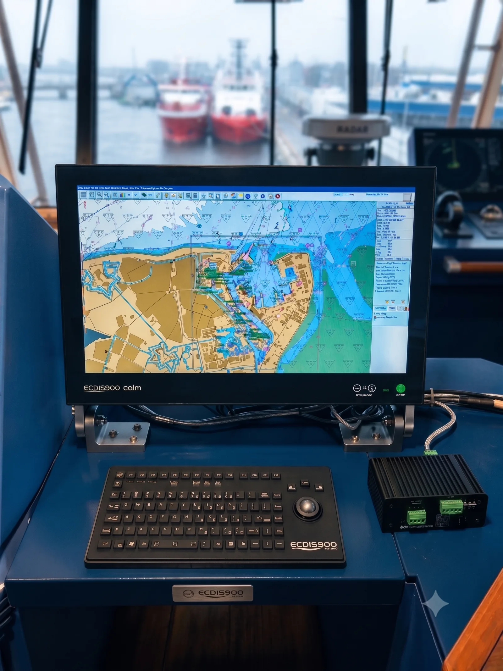
An Electronic Navigational Chart (ENC) is a database, not a picture. Every feature on it, from a buoy or a depth contour to a wreck or a traffic separation scheme, is stored as an object with its own attributes. That is what lets an ECDIS query the chart, filter it and raise an alarm when the planned track crosses a danger. ENC charts are produced by national hydrographic offices to an international standard (IHO S-57), referenced to the WGS 84 datum, and kept current with official updates.
Only charts issued by or on the authority of a government hydrographic office are official, and only official charts can meet the chart-carriage rules of SOLAS. Everything else, however good it looks, is a private chart. Official ENCs are validated and distributed through Regional ENC Coordinating Centres such as PRIMAR and IC-ENC, and sold to ships by authorised distributors: the chart agents who supply ENC services, licences and updates.
There is a second kind of official digital chart, the Raster Navigational Chart (RNC): a georeferenced scan of a paper chart. It looks familiar, but the ECDIS cannot query it or raise the same alarms, which is why ENCs are the standard and RNCs fill gaps. Our guide to AVCS, ARCS, AIO and ADC covers the ADMIRALTY services for both.
How to recognise an official ENC
- When buying: official ENCs are only sold as a service, by distributors authorised by a hydrographic office or a RENC, and the service always includes the updates.
- In the ECDIS: when unofficial data is on screen, the ECDIS shows a permanent warning that the ship must navigate by an up-to-date official paper chart, and marks the boundary of the unofficial data with a special line.
- On the chart itself: querying a cell shows the producing hydrographic office, the edition number and the latest update applied.
- In the name: every official cell has an eight-character name that starts with its producer’s code. More on that below.
ENC cell names and usage bands
ENC data is cut into rectangular cells, each held in its own file of no more than 5 MB. Every cell has a unique eight-character name, built the same way worldwide:
| Characters | Example | Meaning |
|---|---|---|
| 1–2 | GB | The producer: the hydrographic office that made the cell, as a code from IHO S-62 |
| 3 | 6 | The usage band: the navigational purpose the cell was compiled for, from 1 (overview) to 6 (berthing) |
| 4–8 | 1032A | The cell’s own code, chosen by the producer |
So GB61032A, the example the IHO uses in its own standards, is a British cell at berthing scale. The file extension then says which version of that cell a file holds: .000 for a base cell, .001 and upwards for its updates.
What the usage bands mean
Each usage band covers a typical range of compilation scales. The IHO gives these ranges as guidance rather than hard limits:
| Band | Navigational purpose | Typical scale range |
|---|---|---|
| 1 | Overview | 1:1,500,000 and smaller |
| 2 | General | 1:350,000 to 1:1,499,999 |
| 3 | Coastal | 1:90,000 to 1:349,999 |
| 4 | Approach | 1:22,000 to 1:89,999 |
| 5 | Harbour | 1:4,000 to 1:21,999 |
| 6 | Berthing | Larger than 1:4,000 |
Usage bands matter on screen. An ECDIS lets you zoom in far beyond the scale a cell was compiled for, but the data gets no more accurate: any position error in the source is simply magnified, while the symbols stay the same size and look just as precise. That is why the ECDIS shows an overscale indication when you zoom past the compilation scale, and why the right cell for the job is the one in the right band.
What’s inside an ENC update?
Chart updates never arrive as loose files. Whether they come on a disc, as a download or through an automated service, every delivery is an exchange set: a folder with a fixed set of files that tells the ECDIS what is in it, who issued it and where each file belongs. Most official ENC charts today are encrypted under the IHO S-63 scheme, and a typical S-63 exchange set looks like this:
Inside an S-63 exchange set (example)
- SERIAL.ENCWho issued the set, the week and date of issue, base or update media
- INFO
- PRODUCTS.TXTEvery cell in the service, with editions, updates and cancellations
- STATUS.LSTWhich base media this set belongs with
- ENC_ROOT
- CATALOG.031Table of contents: the path of every file in the set
- README.TXTNotices from the data server and hydrographic offices
- GBOne folder per producer
- GB61032AOne folder per cell
- 1Edition 1
- 0The base cell
- GB61032A.000Base cell: the whole chart
- GBN1032A.000Its digital signature
- 1Update 1
- GB61032A.001Update file: only the changes
- GBN1032A.001Its digital signature
The files, one by one
| File | What it does |
|---|---|
| GB61032A.000 | A base cell: the complete chart for one cell at one edition. Every new cell, new edition and re-issue carries the extension .000. |
| GB61032A.001 to .999 | Update files for that cell, numbered in sequence. Each one holds only the changes, as instructions to add, delete or modify individual chart objects. It is never a fresh copy of the chart. |
| GBN1032A.000 | The digital signature for the file of the same name. The usage-band digit becomes a letter (1–6 turns into I–N), so a GB6… cell is signed by a GBN… file. |
| CATALOG.031 | The table of contents for the exchange set. “031” stands for S-57 edition 3.1. It also flags cancelled cells, so the ECDIS can spot them before decrypting anything. |
| README.TXT | Important notices from the data server and the producing hydrographic offices. |
| .TXT and .TIF files | Text and pictures that belong to chart objects, such as notes you would otherwise find in sailing directions. |
| SERIAL.ENC | The first file an ECDIS reads: the data server, the week and date of issue, and whether the set is BASE or UPDATE media. |
| PRODUCTS.TXT | The data server’s full product list: every cell with its edition, latest update, issue dates and any cancellation. |
| PERMIT.TXT | Delivered separately. The cell permits that unlock the encrypted cells for one specific ECDIS, each with an expiry date. |
New editions, re-issues and cancellations
Not every .000 file is a brand-new chart. The same extension is used for three different events, and the edition and update numbers inside the file tell them apart:
- New edition: the hydrographic office has new information that was never sent out as an update, so it issues the whole cell again. The edition number goes up by one and the update count starts again, so the next update is .001.
- Re-issue: the cell is issued again with all updates so far built in, and nothing new. The edition number stays the same and the update sequence carries on: if the re-issue includes update 31, the next update is .032.
- Cancellation: when a cell is withdrawn, the producer sends an update file that contains only the cell’s identification record, with the edition number set to zero. Cancelled cells stay listed on the media for at least 12 months, and the ECDIS must tell the crew that a cell is cancelled, whether it removes it automatically or asks first.
| What happens | File | Edition | Update number |
|---|---|---|---|
| New cell | .000 | 1 | 0 |
| First update | .001 | 1 | 1 |
| Update 31 | .031 | 1 | 31 |
| Re-issue, including updates 1 to 31 | .000 | 1 | 31 |
| Next update | .032 | 1 | 32 |
| New edition | .000 | 2 | 0 |
| First update to edition 2 | .001 | 2 | 1 |
Why updates must be applied in order
Updates to a cell are strictly sequential, and every cell has its own sequence. The ECDIS checks the numbers as it imports: if update 14 is missing, it will not apply update 15 until 14 has been loaded. That protects the chart from changes applied out of order, but it also means one missing file can leave a cell stuck at an old state while every other cell moves on.
Base media and update media
Chart services are built from two kinds of exchange set. Base media hold the complete cells for an area. Update media hold the new editions and all the updates issued since that base. Every update set belongs with particular base media, and STATUS.LST is how the ECDIS checks, before importing, that an update matches the base it already has. For the ADMIRALTY service specifically, see what AVCS base CDs and weekly updates are.
How often do ENC charts need to be updated?
Every week. SOLAS does not name an interval: regulation V/27 asks for charts that are up to date for the intended voyage. But the chart services publish a release every week, so in practice each one is applied as it arrives, and the cells for the next voyage are checked before departure. A skipped week cannot simply be left out either. Updates are sequential, so the missing set has to be loaded before anything newer will go on.
The weekly update is not the only thing that changes on a schedule of its own:
| What changes | How often |
|---|---|
| ENC updates (.001, .002 and on) | Every week, in the chart service’s weekly release. |
| New editions | No fixed schedule. The hydrographic office issues one when it has enough new information, so busy ports and approaches get them more often than ocean charts. They arrive in the weekly release like any other file. |
| Temporary and preliminary notices | Weekly. They are often not built into the ENC itself: in the ADMIRALTY service they come as a separate overlay, AIO, on the same weekly cycle. |
| Paper charts in a backup folio | Corrected by hand every week from the Notices to Mariners. ADMIRALTY publishes them weekly and free of charge. |
A chart is only current if it carries every update issued since its edition. That is why checking matters as much as delivery, and why both get a chapter of their own below.
How ENC updates reach the ship
Hydrographic offices issue changes as they happen, and the major chart services bundle them into a weekly release. From there, the files reach the bridge by one of a few routes:
- Physical media: base and update discs sent to the ship. The traditional route, and still common.
- Email or download: the update is fetched over the ship’s connection, usually onto a crew PC first.
- USB stick: most manual routes end here, with the files copied onto a stick and carried to the ECDIS.
- Automated delivery: a dedicated onboard system receives the updates and hands them to the ECDIS, with no stick and no manual steps.
The manual routes depend on someone remembering, and on a removable device being plugged into the one system the bridge cannot navigate without. DIDI Chart is built to remove both. Each ADMIRALTY AVCS update is collected as soon as it is released, checked against the supplier’s own values before it leaves shore and again on board, then handed to the ECDIS through the interface it already uses. Nothing is installed on the ECDIS, it never goes online, and the crew still decides what goes on and when.
How to check every update has been applied
An ECDIS keeps a record of the updates it has applied to every cell, and it can show them. Most systems can produce an update status report listing each cell with its edition, the latest update applied and its date. It is the first thing to look at after loading a weekly set, and one of the first things an inspector asks for.
- Compare against the service: the latest update for each cell should match what your chart agent or the service’s product list says has been issued.
- Check the dates: a cell whose latest update is much older than its neighbours may be stuck behind a missing file.
- Read the import messages: rejected files, signature errors, expiring permits and cancelled cells are all reported when the set is loaded.
- Keep the evidence: export the report or save a screenshot after each update, so you can show the charts were current on any given date.
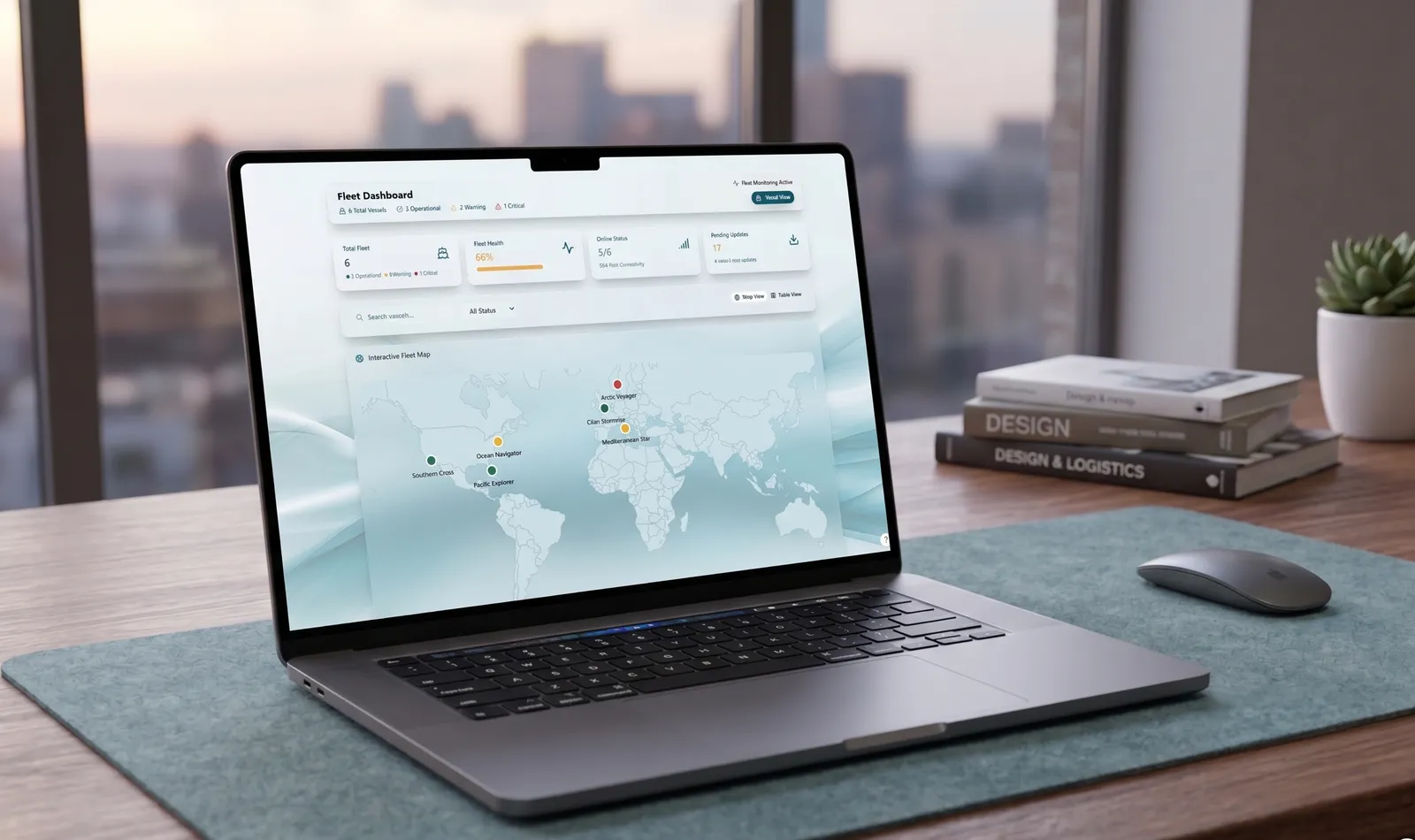
On one ship that is a routine. Across a fleet it is a lot of screenshots. The DIDI Chart fleet dashboard shows the shore office every vessel’s chart status on one screen, with the date and result of each update.
How ENCs are protected: S-63
Most official ENC charts are distributed under IHO S-63, the data protection scheme. It does three jobs:
- Piracy protection: every base cell and update is compressed and encrypted, so the files are useless without a key.
- Selective access: the keys come in cell permits, so a ship can open only the cells it holds a licence for.
- Authentication: every file carries a digital signature from the data server, which the ECDIS checks against a certificate issued under the IHO scheme. A file that has been altered, or did not come from an approved source, fails the check.
Permits, and what happens when they expire
Every ECDIS has a user permit, tied to its hardware by the manufacturer. ENCs are licensed against that user permit, which produces a PERMIT.TXT file of cell permits that only that system can use. Every cell permit carries an expiry date.
The ECDIS starts warning 30 days before a subscription runs out. Once it has expired, the cells stay on screen with a permanent warning, but no base cell or update issued after the expiry date can be installed. An expired permit does not wipe the chart. It freezes it, and a frozen chart soon stops being up to date.
What S-63 does not cover
S-63 proves that a chart file is genuine. It says nothing about the device the file travelled on, and the IHO states plainly that protecting data once it is inside the ECDIS is the manufacturer’s job, not the scheme’s. A correctly signed update can arrive on a USB stick that carries something else too. Every removable device connected to an ECDIS is an open door, which is why the route a chart takes matters as much as the chart itself. Our article on malware on the bridge looks at why those routes deserve attention.
The IHO standards behind ENC charts
| Standard | What it covers |
|---|---|
| S-52 | How ENC data is drawn on an ECDIS: symbols, colours, line styles and the Presentation Library. It is why a buoy looks the same on every type-approved ECDIS. |
| S-57 | The data format for today’s ENCs, including the ENC product specification: cells, file names, editions and updates. |
| S-58 | The validation checks every ENC must pass before release, catching errors such as geometry that crosses itself or soundings on land. |
| S-62 | The list of producer codes: the first two characters of every cell name. |
| S-63 | The data protection scheme: encryption, permits and digital signatures. |
| S-64 | Test data that ECDIS makers use to prove their systems display and update ENCs correctly. |
| S-100 and S-101 | The next generation: a framework for many data layers, and the ENC standard that will succeed S-57. See below. |
The standards change over time, and so does the ECDIS software that implements them. IMO guidance makes clear that an ECDIS not updated to the latest IHO standards may not meet the chart-carriage requirements, so the software version matters as much as the charts.
From ENC to screen: the SENC
An ECDIS does not display ENC files directly. When it imports a cell and its updates, it converts them without loss into its own internal format, the System Electronic Navigational Chart (SENC). The SENC is what the ECDIS draws, queries and checks the route against. It can also hold the mariner’s own additions, such as manual updates, which the ECDIS marks on screen so they are never mistaken for official data.
From the SENC, the ECDIS builds three levels of display:
- Display base: the minimum that can never be switched off. Coastline, the ship’s own safety contour, isolated dangers inside safe water, scale, range and north arrow, units of depth and height, and the display mode.
- Standard display: the minimum for route planning and monitoring. The display base plus the drying line, buoys, beacons and other aids, fairways and channels, conspicuous features, prohibited and restricted areas, chart scale boundaries, cautionary notes and routeing systems.
- All other information, shown on demand: spot soundings, cables and pipelines, details of dangers and aids, magnetic variation, place names, and the ENC edition date and latest update number.
SOLAS rules, backups and gaps in coverage
Chart carriage is set out in SOLAS Chapter V. Regulation 2 defines a nautical chart, regulation 19 lists the equipment each type of ship must carry, and regulation 27 requires charts and publications to be adequate and up to date for the intended voyage. An ECDIS meets the chart requirement only when it is type-approved, runs official ENC charts that are kept up to date, and has an adequate independent backup.
ECDIS carriage itself became mandatory in phases between 2012 and 2018 for ships on international voyages: passenger ships of 500 GT and over, tankers of 3,000 GT and over, and cargo ships of 3,000 GT and over if newly built, or 10,000 GT and over if already in service.
Backup arrangements
The backup has to be independent of the primary ECDIS. In practice that means either a second ECDIS with its own power supply and position input, or an appropriate folio of official, up-to-date paper charts for the voyage.
Where there is no ENC coverage
ENC coverage of the main shipping routes is now close to complete, but gaps remain. Where no ENC exists, an ECDIS can run in raster mode (RCDS) using official RNCs, but only if the flag state allows it, and only together with an appropriate folio of up-to-date paper charts. IMO never defined “appropriate”, so flag states interpret it differently: check yours. Where neither ENCs nor RNCs are available, the ship must carry all the paper charts needed for the voyage.
What S-100 changes
S-100 is the IHO’s new framework for maritime data, and S-101 is the ENC standard inside it that will eventually succeed S-57. Alongside S-101 come layers an ECDIS can combine with the chart, among them high-resolution bathymetry (S-102), water levels (S-104), surface currents (S-111) and navigational warnings (S-124).
The timeline is set by IMO’s revised ECDIS performance standard, MSC.530(106):
| When | What changes |
|---|---|
| November 2022 | IMO adopts the new ECDIS performance standard, giving S-100 ECDIS a regulatory basis. |
| From 1 January 2026 | A new ECDIS may meet either the old standard or the new one. Both are allowed. |
| 2028 (expected) | The UKHO expects type-approved S-100 ECDIS to be on the market. |
| From 1 January 2029 | Every newly installed ECDIS, retrofits included, must meet the new standard and be S-100 capable. |
Three points matter for ships already in service. Existing ECDIS will not have to be replaced. An S-100 ECDIS will still display today’s S-57 ENC charts, so ships will run both formats side by side for years, which the industry calls the “dual fuel” period. And there is currently no planned date for withdrawing S-57. S-100 also brings its own data protection scheme, set out in Part 15 of the standard, as the successor to S-63.
If you are fitting a new ECDIS before 2029, the practical step is the one the UKHO recommends: ask the manufacturer what the upgrade path to S-100 looks like, in software and in hardware.
Quick answers
What is the difference between ECDIS and ECS?
An ECDIS is type-approved to the IMO performance standard and, used with official ENCs and a backup, can replace paper charts under SOLAS. An Electronic Chart System (ECS) can display ENCs but is not type-approved, so it cannot meet the SOLAS chart-carriage rules. It is an aid to navigation, typically on vessels outside SOLAS.
What ECDIS training is required?
Two kinds. The STCW Convention requires generic ECDIS training for deck officers on ships that carry ECDIS, usually based on IMO Model Course 1.27. On top of that, the ISM Code requires type-specific familiarisation with the particular ECDIS on board, which the company must be able to document.
What do port state control inspectors check?
Typically that the ECDIS is type-approved and running current software, that the ENCs for the voyage are official, licensed and up to date, that the backup arrangement is in place, and that officers hold the training and familiarisation records. An update status report and valid permits answer the chart questions quickly.
Do I need a chart agent?
In practice, yes. Official ENC services, permits and updates are sold through distributors authorised by hydrographic offices or RENCs, usually called chart agents. They manage the licences, issue the permits for your ECDIS and keep the updates coming. With DIDI Chart you keep your chart supplier and your existing ENC licences: it changes how the data arrives, not who you buy it from.
What is AVCS?
The ADMIRALTY Vector Chart Service from the UK Hydrographic Office: a worldwide portfolio of official ENCs, updated weekly. Our AVCS explainer covers it alongside ARCS, AIO and ADC.
About this article
- Category
- Navigation
- Published
- Nov 2026
- Read time
- 15 min read
More from News
All articles
Take the riskiest routine off your bridge this quarter.
Tell us about your fleet and routes. A maritime engineer — not a sales script — confirms fit, pricing, and a non-intrusive rollout.